Severe Flood Risk Expands Across Southern States as Storm Systems Intensify
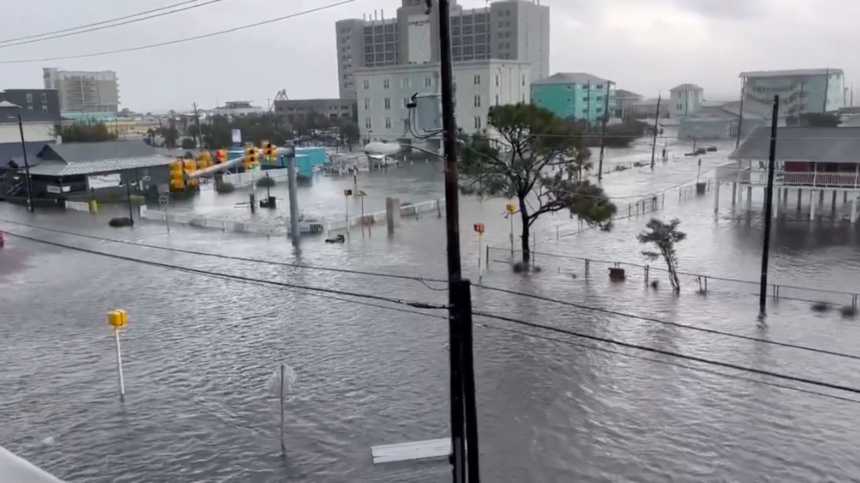
Communities across parts of Georgia, Mississippi, Tennessee, and the broader Mid-South faced growing concerns over severe flood risk this week as multiple storm systems moved through the region, bringing heavy rainfall, flash flood threats, damaging winds, and isolated tornado potential.
- First Alert Weather Day Declared in Southwest Georgia
- Slow-Moving Front Raises Flash Flood Concerns Near Interstate 40
- Why Severe Flood Risk Is Increasing
- Flooding Risks Extend Beyond Immediate Rainfall
- Severe Weather and Climate Extremes Collide
- Public Safety Officials Urge Preparedness
- Extended Wet Pattern May Continue
- The Growing Importance of Flood Awareness
Meteorologists warned that a dangerous combination of slow-moving cold fronts, saturated ground conditions, and repeated rounds of thunderstorms could create hazardous flooding conditions, particularly during overnight and early morning hours when visibility and response times are reduced.
The latest alerts come as many Southern communities are already dealing with extreme weather events ranging from destructive wildfires to drought conditions, underscoring the increasing volatility of seasonal weather patterns across the region.


First Alert Weather Day Declared in Southwest Georgia
In Southwest Georgia, forecasters issued a First Alert Weather Day for Thursday, May 7, 2026, covering the period from 1 a.m. to 3 p.m. as a significant weather system approached the area.
Authorities warned that residents across the region could experience several rounds of intense rainfall and severe thunderstorms capable of producing dangerous conditions overnight and into the morning commute hours.


Officials placed the area under a Marginal Risk category for both severe storms and flash flooding. Forecast models indicated:
- A 5% risk for damaging winds
- A 5% risk for flash flooding
- A 2% risk for a possible tornado
Rainfall projections ranged between 1 and 3 inches across much of the region, while isolated areas could receive more than 4 inches of rain in a short period.
Emergency weather teams urged residents to remain weather aware, especially during overnight hours when storms were expected to become most active. Drivers were strongly advised not to attempt crossing flooded roadways as water levels can rise rapidly and conceal dangerous conditions.
The warning reflected growing concern among forecasters that localized flooding could develop quickly if repeated thunderstorms track over the same areas.


Slow-Moving Front Raises Flash Flood Concerns Near Interstate 40
Meanwhile, weather officials in Tennessee and northern Mississippi warned that another slow-moving cold front was creating elevated flood risks along and south of Interstate 40.
According to regional forecasts, the stalled weather boundary was expected to produce an additional 1.5 to 2 inches of rainfall in some locations, increasing the likelihood of flash flooding throughout the afternoon and evening.
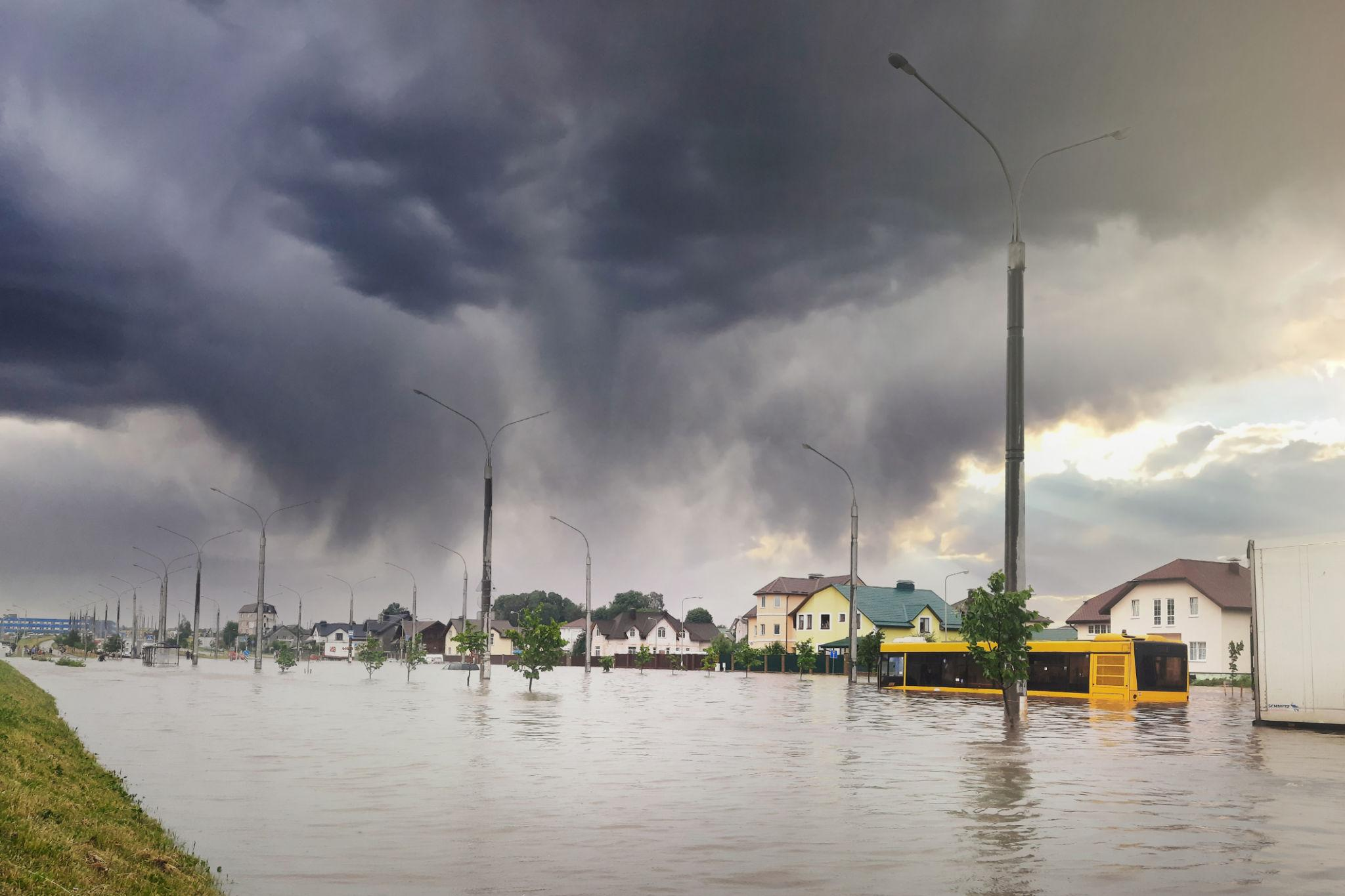
Meteorologists emphasized that the slow progression of the front was particularly concerning because storms moving repeatedly over the same corridors can overwhelm drainage systems, creeks, and low-lying roads.
The National Weather Service encouraged residents to closely follow local advisories and weather warnings as conditions evolved throughout the day.
Unlike fast-moving storm systems that disperse rainfall over wider areas, slow-moving fronts tend to concentrate precipitation in localized zones, significantly increasing flood potential.
Why Severe Flood Risk Is Increasing
Flood experts note that severe flood risks often develop when several atmospheric factors combine simultaneously:
Repeated Thunderstorm Activity
When multiple rounds of thunderstorms pass through the same area, rainfall totals can accumulate rapidly. This phenomenon, often called “training storms,” can produce dangerous flash flooding even if each individual storm is not exceptionally severe.
Saturated Soil Conditions
Ground conditions heavily influence flood severity. If previous rainfall has already saturated the soil, additional precipitation cannot be absorbed efficiently, causing water to run off quickly into streets, rivers, and drainage systems.
Slow-Moving Weather Systems
Slow-moving cold fronts are among the most dangerous flood-producing weather patterns because they prolong rainfall exposure over a region. Forecasters highlighted this concern repeatedly in the latest advisories.
Overnight Storm Timing
Storms occurring overnight create additional risks because many residents are asleep when warnings are issued. Visibility is also reduced for drivers, making flooded roads especially hazardous during early morning travel.
Flooding Risks Extend Beyond Immediate Rainfall
While heavy rainfall is the most visible threat, severe flooding can trigger a wider chain of impacts across affected communities.
Transportation Disruptions
Flooded highways, damaged roads, and reduced visibility frequently disrupt regional transportation networks. Emergency officials routinely warn drivers that even shallow floodwaters can sweep vehicles away.
In many flood-related fatalities, motorists become trapped after attempting to drive through water-covered roads.
Property Damage
Flash flooding can rapidly inundate homes, businesses, and agricultural land. In rural areas, overflowing creeks and drainage ditches may isolate communities and damage infrastructure.
Emergency Response Strain
Periods of simultaneous weather emergencies can place enormous pressure on local emergency services. Parts of South Georgia, for example, were already battling significant wildfire activity while preparing for heavy rainfall and storm threats.
That combination creates unique operational challenges for firefighters, law enforcement agencies, and emergency management teams.
Severe Weather and Climate Extremes Collide
The flood threat emerged during a broader period of weather instability across the South.
Recent weeks have brought:
- Expanding wildfire activity in South Georgia
- Prolonged dry conditions in some areas
- Increasing severe thunderstorm outbreaks
- Abrupt temperature fluctuations
- Heavy rainfall episodes capable of rapid flooding
In Georgia, reports indicated that wildfires had already destroyed more than 120 homes and threatened nearly 1,000 others. Ironically, the incoming rain systems could provide some drought and wildfire relief while simultaneously introducing dangerous flooding risks.
This growing pattern of alternating drought and extreme rainfall events has become increasingly common across many parts of the United States.
Public Safety Officials Urge Preparedness
Weather agencies and emergency management officials emphasized several key safety recommendations as flood threats intensified:
Avoid Flooded Roads
Officials repeatedly reminded residents:
“Turn around, don’t drown.”
Even a small amount of moving water can carry away vehicles, while flooded roads may hide washed-out pavement or debris.
Monitor Weather Alerts
Residents were encouraged to:
- Keep mobile weather alerts enabled
- Monitor local forecasts overnight
- Prepare for rapidly changing conditions
- Identify safe shelter locations in advance
Stay Cautious During Overnight Storms
Because the most active weather periods were expected during overnight and morning hours, authorities warned residents to remain alert even while sleeping by keeping phones charged and weather radios nearby.
Extended Wet Pattern May Continue
Forecasters indicated that unsettled weather could persist into the weekend and early next week in several regions.
Additional showers and thunderstorms remain possible, with some areas expecting continued rainfall chances through Sunday and Monday.
Meteorologists said the prolonged wet pattern may provide beneficial drought relief in some locations, but repeated rainfall events also raise concerns about cumulative flooding impacts if soils remain saturated.
The situation remains highly dependent on storm movement, rainfall intensity, and localized weather development over the coming days.
The Growing Importance of Flood Awareness
The latest weather alerts serve as another reminder that flash flooding remains one of the most dangerous weather hazards in the United States.
Unlike hurricanes or large winter storms that provide days of preparation time, flash floods can develop within minutes, especially when thunderstorms repeatedly move across vulnerable areas.
Weather experts stress that public awareness, rapid warning systems, and community preparedness are increasingly important as severe rainfall events become more frequent and intense.
For residents in flood-prone regions, understanding weather alerts and reacting quickly to evacuation or safety warnings can make the difference between safety and disaster.