Western Cape Storm: South Africa Braces for Destructive Rain, Flooding and Coastal Chaos
The Western Cape is facing one of the most serious weather threats of the year as authorities race to prepare for a powerful storm system expected to bring flooding, dangerous winds, mudslides, and widespread disruption across parts of South Africa.
- A Level 8 Warning Raises Alarm Across the Province
- Schools Closed as Safety Concerns Grow
- Flooding Threat Expands Beyond the Western Cape
- Dangerous Seas and Gale-Force Winds Threaten Coastal Areas
- Communities Face Rising Flood Risks
- Public Urged to Avoid Travel and Stay Alert
- Insurance Experts Warn About Property Damage Risks
- A Nation on Weather Alert
- Conclusion
Emergency teams have been activated across the province after the South African Weather Service (SAWS) issued an Orange Level 8 warning for disruptive rainfall — one of the highest severe weather alerts in the country’s warning system. The storm is expected to intensify between 5 and 7 May 2026, with the Garden Route and Little Karoo regions likely to experience the worst impacts.
Forecasters warn that rainfall totals could reach between 100mm and 200mm in some areas, significantly increasing the risk of flash flooding, overflowing rivers, landslides, and infrastructure damage. Coastal communities are also being warned about dangerous sea conditions and gale-force winds as authorities urge residents to avoid unnecessary travel and remain on high alert.
The storm has already triggered school closures, road monitoring operations, emergency deployments, and flood response preparations across multiple municipalities.


A Level 8 Warning Raises Alarm Across the Province
The South African Weather Service confirmed that an intense cut-off low pressure system is driving the severe weather event. These systems are known for producing prolonged rainfall and unstable atmospheric conditions capable of causing widespread disruption.


The most severe warning has been issued for the eastern parts of the Garden Route, including:
- George
- Knysna
- Mossel Bay
- Bitou
- Oudtshoorn
SAWS warned that these regions could experience “severe impacts” as rainfall intensifies over already vulnerable terrain.
Authorities say the combination of saturated ground, mountainous landscapes, and vulnerable infrastructure creates ideal conditions for flash floods and mudslides.
The Western Cape Disaster Management Centre has placed emergency response teams on standby, while municipalities have been clearing stormwater drainage systems in anticipation of flooding.


Colin Deiner, head of the Western Cape Disaster Management Centre, said officials are closely monitoring developments as the storm approaches. Municipal teams in the Garden Route and Little Karoo regions have been preparing for days ahead of the expected landfall.
Schools Closed as Safety Concerns Grow
One of the clearest signs of the storm’s seriousness has been the decision to close schools across vulnerable districts in the Western Cape.
Authorities confirmed that schools in George, Knysna, Oudtshoorn, and surrounding regions would remain closed on Wednesday, 6 May and Thursday, 7 May 2026.
The closures affect public ordinary and special needs schools in parts of the Eden and Central Karoo education district. According to regional reports, more than 120 schools could be impacted.
Officials said the decision followed consultations between education authorities, disaster management teams, and weather experts.
Flooded roads, dangerous transport routes, and possible infrastructure damage were cited as major concerns, especially in rural and low-lying communities.
Parents were advised to monitor official communication channels, including SMS systems and WhatsApp groups, for updates regarding school reopenings and changing conditions.
Flooding Threat Expands Beyond the Western Cape
Although the Western Cape remains the storm’s primary focus, severe weather warnings have also been issued for several other provinces.
In the Eastern Cape, Nelson Mandela Bay, Kou-Kamma, and Kouga municipalities are also under an Orange Level 8 warning for disruptive rain and flooding.
Eastern Cape weather forecaster Ayabonga Tshungwana warned that flooding of roads, settlements, and low-lying areas was highly likely as the weather system moved eastward.
Strong winds and rough seas are also expected to impact coastal communities in the Eastern Cape.
Heavy rainfall has already caused localized flooding and power outages in parts of Nelson Mandela Bay Metro, including:
- Markman
- Blue Water Bay
- Amsterdam
- Summerstrand
Safety and Security Executive Director Shadrack Sibiya confirmed that several areas experienced electricity disruptions during the storm conditions.
“There is only one road that has been closed, it’s Third Avenue. We closed it to avoid any fatalities or any incidents that may occur,” Sibiya said.
He added that authorities were closely monitoring rising sea swells and worsening weather conditions as emergency crews worked to restore electricity in affected areas.
Dangerous Seas and Gale-Force Winds Threaten Coastal Areas
The severe weather system is not limited to heavy rain.
Authorities have also issued warnings for:
- Gale-force coastal winds
- High sea swells
- Dangerous waves
- Possible coastal infrastructure damage
- Marine transport disruptions
Conditions between Cape Agulhas and Plettenberg Bay are expected to become particularly hazardous.
Weather officials warned that wave heights could threaten harbours, roads, and coastal properties, while fishing and marine activities may become extremely dangerous.
Motorists travelling along coastal routes and mountain passes have also been warned about falling rocks, reduced visibility, and flooded roads.
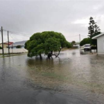
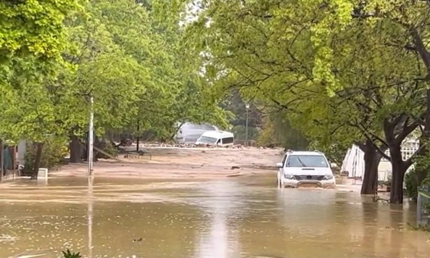
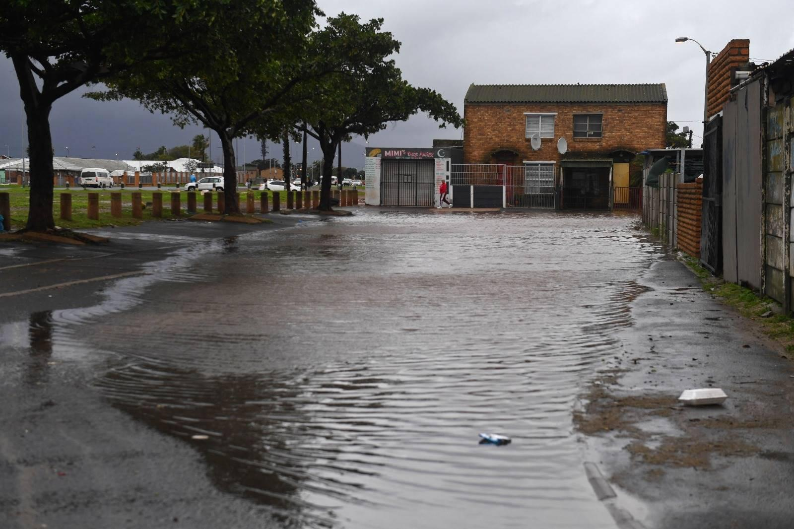
Communities Face Rising Flood Risks
The threat of flooding remains one of the biggest concerns for emergency officials.
SAWS warned that low-lying communities, informal settlements, and flood-prone regions could become inaccessible if rivers overflow or roads are washed away.
Authorities also warned of:
- Mudslides in wildfire-affected areas
- Rockfalls in mountainous terrain
- Damage to homes and infrastructure
- Livestock losses
- Transport disruptions
- Flooded bridges and roads
Communities located near rivers and streams have been advised not to attempt crossings under any circumstances.
Officials are also monitoring dam levels as persistent rainfall continues across affected catchment areas.
Public Urged to Avoid Travel and Stay Alert
Emergency authorities across the Western Cape and Eastern Cape have issued strong public safety warnings.
Residents have been urged to:
- Avoid unnecessary travel
- Stay away from rivers and flooded roads
- Monitor weather updates regularly
- Move valuables to higher ground
- Prepare emergency supplies
- Avoid coastal and marine activities
SAWS advised residents to postpone travel until conditions improve and to follow updates from municipal disaster management teams.
The warning system used by SAWS ranges from Level 1 to Level 10, with Level 8 indicating a high probability of significant disruption and danger to life.
Insurance Experts Warn About Property Damage Risks
As heavy rain and cold conditions intensify, insurance companies are also warning residents about increased risks to homes and vehicles.
Santam advised homeowners to conduct preventative maintenance, including checking roofs for leaks and clearing gutters to improve water drainage.
Marius Kemp, Head of Personal Underwriting at Santam, warned that cold conditions could also lead to water pipe failures.
“The cold weather contributes to the bursting of water pipes,” Kemp said.
Vehicle insurers have also urged motorists to avoid flooded roads and reduce speed during heavy rain to lower accident risks.
A Nation on Weather Alert
The severe weather system has placed large parts of South Africa under varying warning levels.
KwaZulu-Natal is currently under an Orange Level 6 warning for severe thunderstorms and localized flooding, while Gauteng and several inland provinces face Yellow Level 2 to 4 warnings.
Disaster response teams across the country remain on standby as forecasters continue monitoring the storm’s path and intensity.
For residents in the Western Cape, however, the next 48 hours could prove especially dangerous as heavy rain, strong winds, and rising rivers threaten homes, roads, schools, and businesses across the province.
Authorities say preparation and caution will be critical in minimizing injuries and preventing fatalities as the storm system moves across the region.
Conclusion
The Western Cape storm has rapidly evolved into a major national weather emergency, prompting high-level warnings, school closures, emergency deployments, and widespread public safety alerts.
With up to 200mm of rain forecast in some areas, officials fear severe flooding, infrastructure damage, and dangerous coastal conditions could impact thousands of residents across the province and beyond.
As municipalities, emergency services, and weather officials work around the clock to manage the crisis, residents are being urged to remain vigilant, avoid unnecessary risks, and follow official guidance closely until conditions stabilize.