Heavy Snow Warning: Which States Are Affected Today?
A Dangerous Spring Storm Sweeps Across the Rockies
A powerful late-season winter storm is sweeping across the western United States, prompting urgent warnings from meteorologists and local authorities. Despite the arrival of spring, conditions in parts of the Mountain West are expected to resemble mid-winter extremes, with heavy snowfall, strong winds, and hazardous travel conditions unfolding across multiple states.
- A Dangerous Spring Storm Sweeps Across the Rockies
- Which States Are Under Heavy Snow Warnings?
- Snowfall Totals: From Inches to Feet
- Winds and Whiteout Conditions Raise the Stakes
- Travel Disruptions and Infrastructure Risks
- How the Storm Developed
- What Residents Should Do Now
- A Reminder of Nature’s Unpredictability
The National Weather Service (NWS) has issued widespread winter weather advisories, warning residents to prepare for “dangerous conditions” as snow accumulations intensify through Sunday and into early Monday.
At the center of the storm are Colorado, Wyoming, and Montana—states now bracing for significant snowfall totals and severe disruptions.


Which States Are Under Heavy Snow Warnings?
Core Impact Zone: Colorado, Wyoming, and Montana
The primary focus of the storm lies in the Northern and Central Rockies, where winter weather warnings remain active.
- Wyoming: Mountain ranges such as the Sierra Madre and Snowy Range are expected to see the most intense snowfall, with communities like Albany and Centennial directly in the path of the storm.
- Colorado: High-elevation areas including Crested Butte, Monarch Pass, and Grand Mesa are under strict advisories due to rapid snow accumulation and strong winds.
- Montana: While slightly less severe, parts of southern Montana continue to experience ongoing snowfall, adding to earlier accumulations.
In addition to these core states, the storm system is influencing a broader region. Winter weather alerts extend to areas in California, Nevada, Oregon, Washington, and Idaho, as the system moves northeast toward the Upper Midwest.


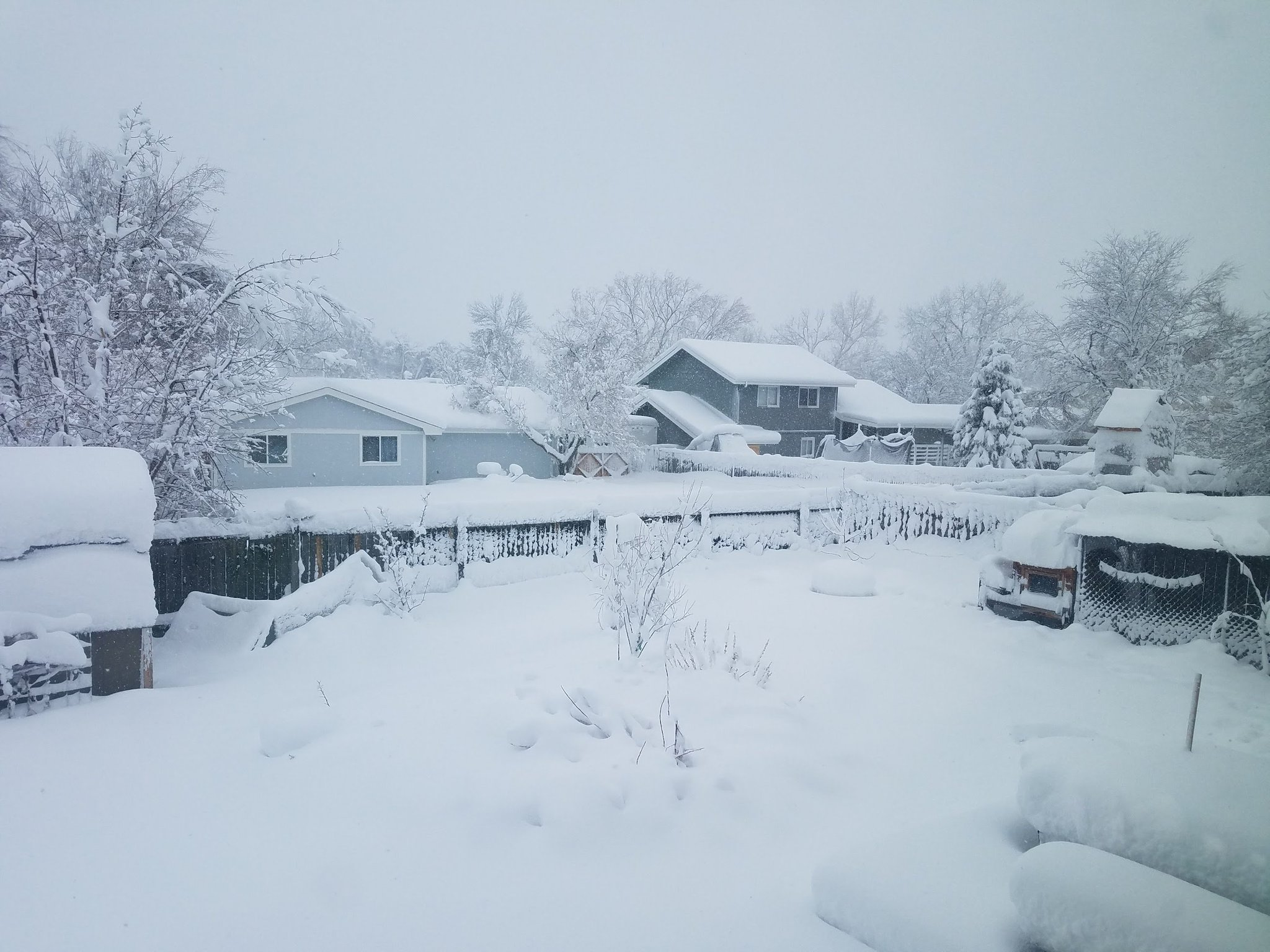
Snowfall Totals: From Inches to Feet
The severity of this storm becomes clear when examining projected snowfall totals, which vary significantly depending on elevation.
- Battle Pass, Wyoming: Up to 24 inches of snow expected
- Grand Mesa, Colorado: Up to 24 inches possible
- Crested Butte, Colorado: Around 10 to 12 inches
- Southern Montana: Approximately 6 to 10 inches
Lower elevations may see a mix of rain and slush, but higher terrain is likely to experience heavy, wet snow capable of causing structural and environmental damage.
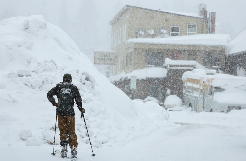
Winds and Whiteout Conditions Raise the Stakes
Snowfall alone does not define the danger of this storm. Wind gusts reaching 45 mph are expected to combine with falling snow to create near-zero visibility in exposed areas.
According to the NWS, blowing snow will significantly reduce visibility, making travel “very difficult.”


This combination of wind and snow increases the likelihood of:
- Whiteout conditions, where visibility drops to almost zero
- Disorientation for outdoor travelers, especially in mountainous terrain
- Rapid weather shifts, with conditions deteriorating within minutes
Authorities have issued specific warnings to hunters, hikers, and snowmobilers, noting that such conditions can quickly become life-threatening.
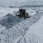
Travel Disruptions and Infrastructure Risks
Roads Becoming Impassable
Mountain passes across Colorado and Wyoming are expected to become extremely hazardous, with some routes potentially closing due to snow buildup and poor visibility.
Drivers are being urged to delay non-essential travel, as even well-equipped vehicles may struggle in rapidly worsening conditions.
Power Outages and Falling Debris
An additional concern stems from the weight of wet snow accumulating on trees that have already begun budding for spring. This increases the risk of:
- Broken branches
- Downed power lines
- Blocked secondary roads
Localized power outages are considered likely in the hardest-hit areas.
How the Storm Developed
Meteorologists trace the origin of this system to an upper-level disturbance that formed over California before intensifying as it moved eastward.
As it travels across the Rockies, the system is pulling in cold air and moisture, creating ideal conditions for heavy snowfall at higher elevations. It is expected to continue tracking northeast, eventually reaching the Upper Midwest by Monday evening.
What Residents Should Do Now
Authorities and weather agencies are urging residents in affected regions to take immediate precautions:
- Avoid unnecessary travel, especially through mountain passes
- Prepare emergency kits in vehicles, including food, water, and blankets
- Monitor official NWS updates for rapidly changing conditions
- Stay indoors during peak storm activity, if possible
The advisory emphasizes that even experienced travelers can be caught off guard by the sudden onset of whiteout conditions.
A Reminder of Nature’s Unpredictability
This late-season snowstorm underscores the volatile nature of weather in the Rocky Mountain region. While spring typically signals warming temperatures, high-elevation areas remain vulnerable to severe winter events well into April.
The current storm serves as a stark reminder that seasonal transitions do not eliminate risk—especially in mountainous terrain where conditions can shift dramatically within hours.
As the system moves eastward in the coming days, attention will turn to potential impacts in other regions. For now, however, the focus remains firmly on the Rockies, where residents are navigating one of the most significant late-season snow events of the year.