Tornado Warning Explained: Real-Time Alerts, Risks, and How to Stay Safe
When Seconds Matter: Understanding a Tornado Warning
Late on April 14, 2026, weather authorities issued urgent alerts across parts of the United States as severe storms intensified overnight. In one case, at 11:56 p.m. EDT, a tornado warning was declared for Saginaw County after a dangerous storm system was detected moving east at 40 mph. The alert was clear and direct: conditions were favorable for a tornado, and immediate action was required.
A tornado warning is not a routine weather update—it is a high-level emergency notification. Unlike a tornado watch, which signals the possibility of tornado formation, a warning indicates that a tornado has either been spotted or is strongly indicated by radar. At that point, the emphasis shifts from preparedness to immediate protection.
What Triggered the Warning
The warning issued for Saginaw County followed the detection of a severe thunderstorm capable of producing a tornado. According to the official statement:
“Flying debris will be dangerous to those caught without shelter. Mobile homes will be damaged or destroyed. Damage to roofs, windows, and vehicles will occur. Tree damage is likely.”
The storm’s projected path placed communities such as Birch Run and Bridgeport at risk around midnight, with Frankenmuth expected to be impacted shortly after. This type of precise forecasting—down to specific towns and time windows—is critical in enabling residents to act quickly.
In a separate alert from northeastern Oklahoma, a similar warning described a storm moving northeast at 55 mph near Jenks Riverside Airport. The risks were consistent: radar-indicated tornado activity, potential hail, and widespread structural damage.
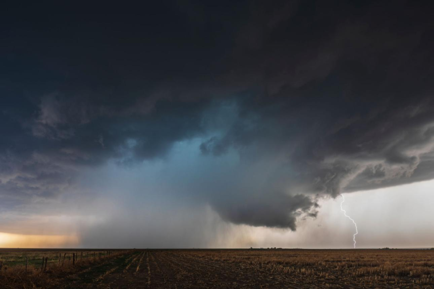
The Anatomy of a Tornado Threat
Tornadoes typically develop from severe thunderstorms, particularly supercells—rotating storm systems with strong updrafts. These storms can produce funnel clouds that descend from the sky and touch the ground, creating intense, localized destruction.
Key characteristics of tornado-producing storms include:
- Rapid wind rotation within the storm system
- Sudden changes in atmospheric pressure
- High wind speeds, often exceeding 100 mph
- The presence of large hail and heavy rainfall
Once a tornado forms—or is about to form—the window for response becomes extremely narrow. This is why warnings emphasize urgency and clarity.
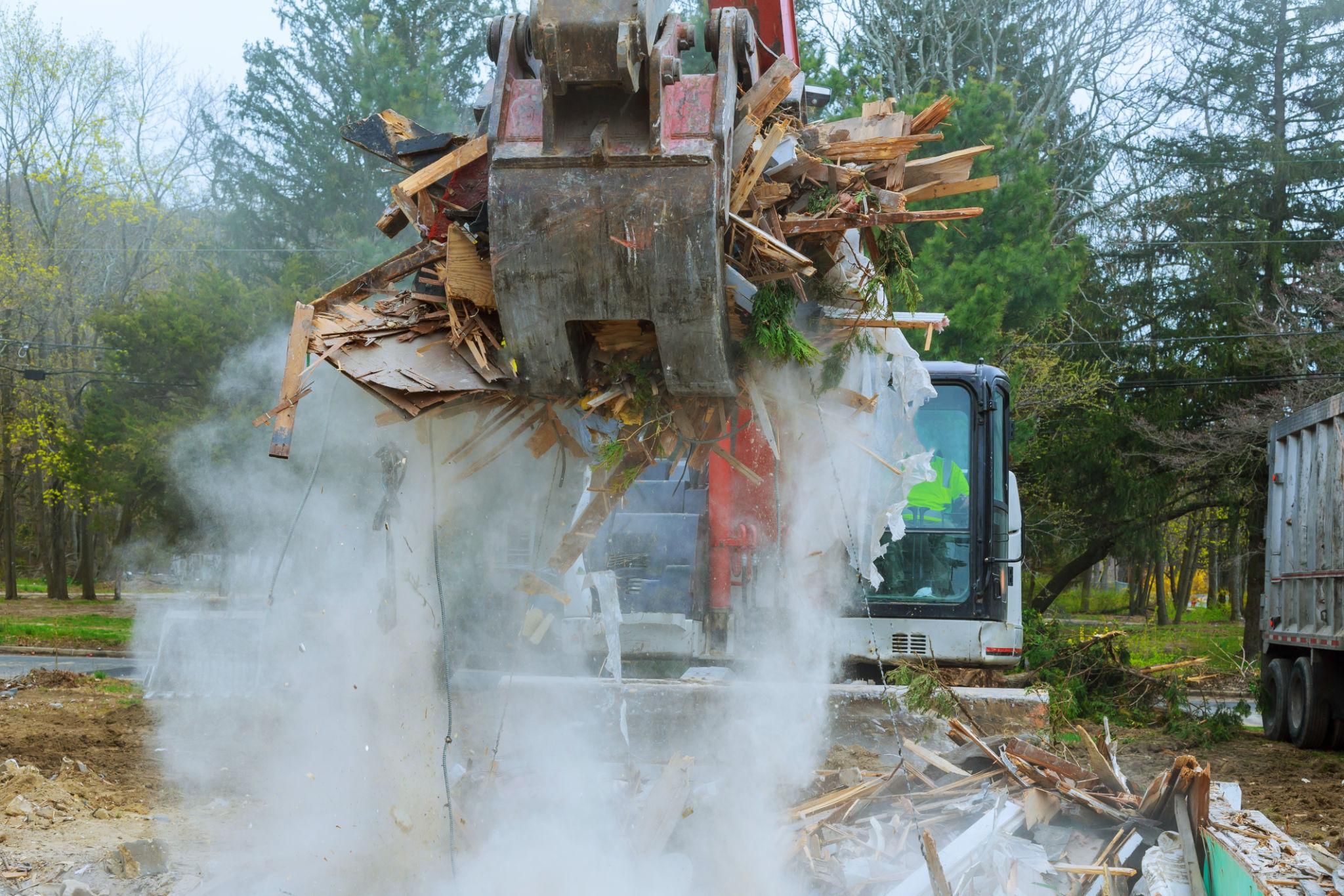
What the Impacts Look Like on the Ground
The consequences outlined in official warnings are not hypothetical—they reflect well-documented patterns of tornado damage. The alerts consistently highlight several high-risk outcomes:
- Flying debris: The leading cause of injury and death during tornadoes
- Structural damage: Roofs torn off, windows shattered, buildings partially or fully destroyed
- Vehicle destruction: Cars overturned or crushed by debris
- Tree damage: Uprooted or snapped trees, often blocking roads and damaging infrastructure
In metro Detroit, for example, severe storms associated with tornado warnings caused visible destruction, including a commercial building where part of the roof was torn away. Such incidents illustrate how quickly damage can occur, even in urban areas.
Safety Protocols: What to Do During a Tornado Warning
A tornado warning demands immediate action. The goal is simple: get to the safest possible location before the storm arrives.
Here are the essential steps to follow:
- Move to the lowest level of your building
Basements provide the highest level of protection. If unavailable, use an interior room on the lowest floor. - Stay away from windows
Glass can shatter under pressure or from debris impact. - Use barriers for protection
Cover yourself with heavy objects like mattresses, blankets, or helmets to reduce injury risk. - Avoid mobile homes and vehicles
These structures offer little resistance to tornado-force winds. Relocate to a more secure shelter if possible. - Monitor updates continuously
Weather conditions can evolve rapidly. Stay tuned to official channels for real-time information.
These steps are not optional—they are standard emergency procedures designed to maximize survival.
The Role of Weather Services and Technology
Organizations such as the National Weather Service play a central role in detecting and communicating tornado threats. Using Doppler radar, satellite imagery, and ground observations, meteorologists can identify storm rotation and issue warnings with increasing precision.
Modern alert systems also leverage:
- Mobile notifications and emergency alerts
- Local broadcast interruptions
- Community alert systems such as CodeRED
These technologies ensure that warnings reach as many people as possible, even late at night when storms often intensify.
Why Tornado Warnings Are Increasingly Critical
Severe weather patterns appear to be growing more volatile in certain regions, with storms forming rapidly and intensifying quickly. This increases the importance of fast, accurate warning systems.
Additionally, population growth in vulnerable areas means more people are exposed to potential tornado impacts. Urban expansion into previously rural zones can amplify the scale of damage and complicate emergency response efforts.
Looking Ahead: Preparedness as a Necessity
Tornado warnings will remain a critical component of public safety infrastructure. The events of April 2026 underscore a consistent reality: severe storms can develop quickly, move fast, and cause significant damage within minutes.
Preparedness is no longer a seasonal concern—it is an ongoing responsibility. Households, businesses, and local governments must maintain clear emergency plans, access to reliable alerts, and an understanding of proper safety procedures.
Conclusion
A tornado warning is one of the most urgent weather alerts issued. It signals immediate danger and requires decisive action. The recent warnings in Michigan and Oklahoma demonstrate how quickly conditions can escalate and how vital timely communication is.
Understanding what a tornado warning means—and how to respond—can make a measurable difference in outcomes. In severe weather situations, awareness and preparation are not just helpful; they are essential.