Heavy Snow Warning: A Late-Season Storm Disrupts Spring Across the U.S.
A Sudden Return to Winter
Spring may be well underway on the calendar, but across large parts of the United States, the weather tells a very different story. A powerful late-season storm system has triggered widespread heavy snow warnings, bringing blizzard-like conditions, dangerous winds, and travel disruptions—particularly across the western and central regions.
- A Sudden Return to Winter
- What Is a Heavy Snow Warning?
- Regions in the Storm’s Path
- Wind, Visibility, and Whiteout Conditions
- Travel Disruptions and Public Safety Concerns
- A Dual Threat: Snow and Severe Weather
- Why This Storm Is So Unusual
- Snowfall Totals and Timeline
- What Residents Should Do
- A Reminder of Nature’s Unpredictability
Meteorologists describe the event as highly unusual for late April, with some areas facing snowfall totals more typical of mid-winter. The National Weather Service (NWS) has issued multiple alerts, warning of hazardous conditions that could significantly impact daily life, transportation, and safety.
What Is a Heavy Snow Warning?
A heavy snow warning is issued when forecasters expect significant snowfall capable of disrupting normal activities. It often signals dangerous travel conditions, reduced visibility, and potential risks to infrastructure.


Unlike a general winter advisory, a heavy snow warning indicates more severe impacts, including:
- Rapid snow accumulation
- Strong winds creating whiteout conditions
- Slippery or impassable roads
- Increased likelihood of accidents and delays
Authorities emphasize that such warnings should be taken seriously, especially when accompanied by high winds or freezing temperatures.


Regions in the Storm’s Path
Western States Facing the Brunt
The most severely affected areas lie in the Mountain West, including:
- Colorado
- Wyoming
- Montana
These regions are expected to experience intense snowfall, particularly at higher elevations, where totals could reach up to 24 inches in localized areas.
Specific projections highlight the storm’s intensity:
- Battle Pass (Wyoming): 18–24 inches
- Grand Mesa (Colorado): Up to 24 inches
- Crested Butte (Colorado): 10–12 inches
- Southern Montana: 6–10 inches
Even areas with lower snowfall totals are facing hazardous conditions due to strong winds and icy surfaces.


Wind, Visibility, and Whiteout Conditions
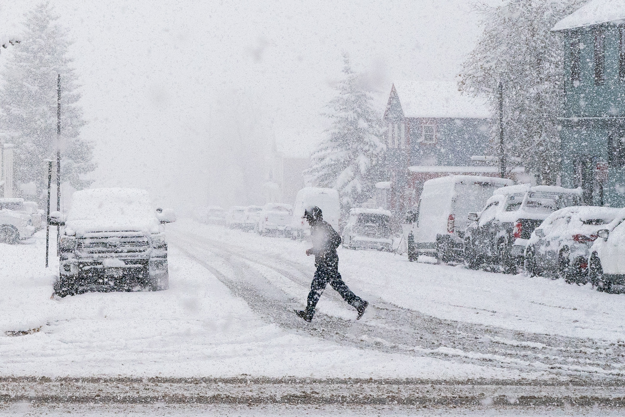
Snowfall alone does not define the danger of this storm. Wind gusts reaching 45 to 55 miles per hour are expected to combine with falling snow to create near-zero visibility.
This phenomenon, known as a whiteout, can occur suddenly, leaving drivers disoriented and unable to see the road.
Officials warn that:
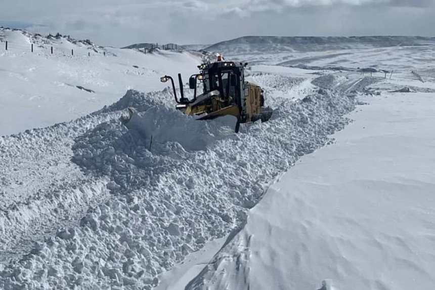
- Mountain passes may become impassable
- Visibility can drop within minutes during snow squalls
- Travel risks increase dramatically, especially in exposed terrain
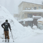
In some areas, conditions are described as “dangerous,” particularly for outdoor travelers such as hikers and snowmobilers.
Travel Disruptions and Public Safety Concerns
Roads and Commutes at Risk
Transportation networks are among the hardest hit. The NWS has warned that:
- Roads may become slick and snow-covered
- Bridges and overpasses could develop ice rapidly
- Morning commutes, particularly on April 27, could be hazardous
Interstates and mountain routes face the highest risk of closures or severe delays. In Wyoming, for example, motorists have been advised to prepare for “slippery” conditions and reduced visibility along key routes.
Aviation and Outdoor Travel
Air travel and outdoor activities are also affected:
- Flights may face delays due to poor visibility
- Backcountry travel is strongly discouraged
- Sudden weather changes increase risk for adventurers
Authorities consistently urge residents to postpone non-essential travel until conditions improve.
A Dual Threat: Snow and Severe Weather
While the western states contend with snow, the storm system is triggering severe weather elsewhere.
Across the central and eastern U.S., meteorologists forecast:
- Thunderstorms
- Tornadoes
- Large hail
- Wind gusts exceeding 55 mph
As the system moves east, it could also bring flash flooding, particularly where rainfall combines with melting snow.
This dual threat underscores the complexity of the storm, affecting different regions in dramatically different ways.
Why This Storm Is So Unusual
Late-season snow is not unheard of, especially in mountainous regions. However, the scale and intensity of this event stand out.
Several factors contribute to its severity:
- A strong upper-level atmospheric disturbance
- Cold air persisting later into spring than usual
- Moisture-rich systems moving inland
Adding to the risk is the timing. Trees and vegetation have already begun spring growth, making them more vulnerable to heavy, wet snow, which can:
- Snap branches
- Damage power lines
- Cause widespread outages
The result is a storm that behaves more like a mid-winter blizzard than a spring weather event.
Snowfall Totals and Timeline
The storm is expected to unfold over several days, with peak accumulation occurring between late April 26 and April 28.
Forecast highlights include:
- 5–15 inches common across many mountainous areas
- Over 2 feet possible in higher elevations
- Snow levels fluctuating between 8,000 and 10,000 feet
Conditions are expected to gradually ease later in the week, with temperatures slowly rising and snowfall decreasing.
What Residents Should Do
Authorities across affected states are urging residents to take proactive measures:
- Delay non-essential travel
- Stock emergency supplies (food, water, batteries)
- Prepare for possible power outages
- Equip vehicles with winter safety kits
- Monitor official weather updates closely
Simple precautions can significantly reduce risk during severe winter weather events.
A Reminder of Nature’s Unpredictability
This heavy snow warning highlights a broader reality: seasonal transitions are not always predictable. Even as spring advances, winter conditions can return abruptly with serious consequences.
The current storm serves as a reminder of the need for preparedness, flexibility, and attention to official forecasts. For millions of Americans, the coming days will require caution, patience, and resilience as winter briefly reclaims the landscape.