Megatsunami: The Monster Waves That Could Reshape Entire Coastlines
In the early hours of August 10, 2025, a wall of water surged through Alaska’s Tracy Arm fjord with such force that it ripped forests from mountainsides, hurled debris across islands, and left scars visible from space. Scientists would later determine the wave reached an astonishing 1,578 feet high — making it one of the largest megatsunamis ever recorded.
- What Is a Megatsunami?
- The Alaska Megatsunami That Shocked Scientists
- Why No One Died
- The Ancient Clue Hidden in Tonga
- Climate Change and Rising Geological Risks
- Why Fjords Are Especially Dangerous
- Could Megatsunamis Threaten Modern Cities?
- Satellites Are Becoming Essential Warning Tools
- A Warning Written Into the Landscape
The event was more than a dramatic geological accident. Researchers now see it as a warning about a rapidly changing planet where melting glaciers, unstable mountainsides, and tectonic activity may combine to create increasingly dangerous coastal disasters.
At the same time, another scientific discovery in the Pacific has reinforced how powerful these events can become. In Tonga, researchers studying a gigantic limestone boulder known as Maka Lahi concluded that an ancient megatsunami likely hurled the rock hundreds of feet inland nearly 7,000 years ago.
Together, these discoveries are reshaping scientific understanding of megatsunamis — rare but catastrophic waves capable of transforming landscapes within minutes.


What Is a Megatsunami?
Unlike conventional tsunamis triggered primarily by undersea earthquakes, megatsunamis are caused by sudden massive displacements of water from landslides, volcanic eruptions, glacier collapses, or meteor impacts.


These waves are far taller than ordinary tsunamis because the energy is concentrated into confined spaces such as fjords, bays, or narrow coastlines.
Scientists describe them as localized but extraordinarily destructive.
The Alaska event demonstrated this perfectly. When at least 64 million cubic meters of rock plunged into Tracy Arm fjord after the retreat of South Sawyer Glacier, the displaced water exploded upward into a towering wave.
The force generated seismic signals equivalent to a magnitude 5.4 earthquake and produced vibrations detected around the world for days.


The Alaska Megatsunami That Shocked Scientists
A Glacier Retreat Set the Stage
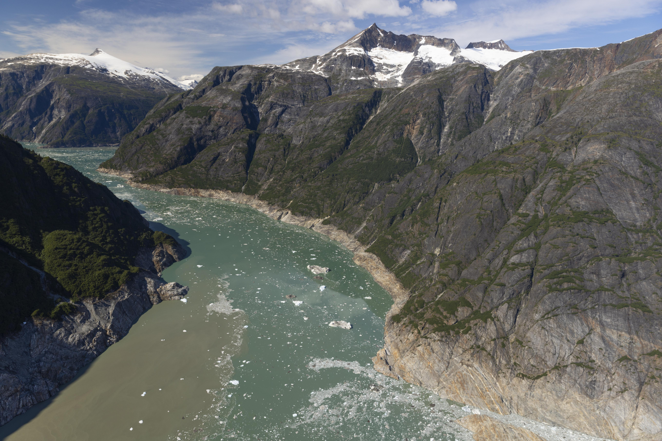
Tracy Arm is a glacial fjord in southeast Alaska carved over thousands of years by moving ice. But in recent decades, warming temperatures accelerated the retreat of South Sawyer Glacier.
Scientists believe the glacier had previously acted like a support structure for the steep mountainside above it. As the ice rapidly melted away, the cliff became unstable.
Then disaster struck.
On August 10, 2025, enormous volumes of rock collapsed into the fjord in less than a minute. Researchers later estimated the amount of falling rock equaled roughly 24 Great Pyramids of Giza.
The resulting wave stripped vegetation from the fjord walls up to 1,578 feet above sea level. Trees vanished, soil was torn away, and islands farther down the fjord turned from lush green to barren brown landscapes.
Satellite imagery captured before-and-after scenes that researchers described as impossible to ignore.
NASA-USGS Landsat satellites photographed Tracy Arm on July 26 and again on August 19, revealing a massive landslide scar and what scientists called a “bathtub ring” marking where forests had been obliterated by water.
Why No One Died
One of the most unsettling aspects of the disaster is how narrowly catastrophe was avoided.
The wave struck around 5:30 a.m., before tourist cruise ships entered the fjord. Researchers repeatedly emphasized that timing alone prevented major casualties.
Kayakers camping near Harbor Island lost equipment when the water surged through the system, while passengers aboard a nearby cruise vessel reported sudden currents and dramatic water-level swings.
Dan Shugar, the lead author of the study published in Science, warned:
“The fact that the landslide occurred this early in the morning was unbelievably lucky. Next time — and there will be a next time — we may not be so lucky.”
Researchers now fear that expanding tourism into remote polar regions could place more people in danger as unstable glacial landscapes become increasingly common.
The Ancient Clue Hidden in Tonga
While Alaska revealed the modern danger of megatsunamis, Tonga provided evidence that such monster waves have shaped coastlines for thousands of years.
Scientists investigating a giant limestone boulder called Maka Lahi found it sitting nearly 650 feet from the nearest cliff edge and more than 120 feet above sea level.
The rock measures about 46 feet across and weighs more than 1,000 tons. Researchers quickly concluded ordinary storms could never move something so enormous uphill.
Computer simulations confirmed their suspicions.
Even powerful storm systems failed to produce enough force. Only a massive wave roughly 164 feet high lasting nearly 90 seconds could explain the boulder’s position.
The dating of limestone deposits suggested the event occurred around 6,800 years ago, likely triggered by a giant underwater landslide near the Tonga-Kermadec subduction zone — one of the world’s most tectonically active regions.
Researchers believe the boulder now stands as geological evidence of an ancient megatsunami powerful enough to reshape the Pacific coastline.
Climate Change and Rising Geological Risks
One of the most important conclusions emerging from recent megatsunami research is the growing connection between climate change and geological instability.
In Alaska, scientists directly linked glacier retreat to the collapse that triggered the Tracy Arm wave.
As glaciers melt, they remove physical support from mountainsides that may have remained stable for centuries. That process creates conditions where enormous rockslides become increasingly likely.
Dr. Bretwood Higman warned that such events may already be becoming significantly more common.
“At this point, I’m pretty confident that these are increasing not just a little bit, but increasing a lot.”
Some scientists estimate megatsunami-producing collapses in vulnerable regions could now occur up to ten times more frequently than only a few decades ago.
Why Fjords Are Especially Dangerous
Narrow fjords amplify megatsunami waves in ways open oceans do not.
When massive amounts of water are suddenly displaced inside confined channels, the energy has nowhere to spread outward. Instead, it surges vertically and violently against nearby cliffs.
That is why the Tracy Arm wave rose higher than skyscrapers.
The fjord itself acted like a giant funnel, concentrating unimaginable amounts of energy into a small area.
Scientists say Alaska, Greenland, Norway, and parts of Chile are especially vulnerable because they combine steep terrain, active glaciers, and tectonic instability.
Could Megatsunamis Threaten Modern Cities?
Most megatsunamis remain localized events. They do not usually travel across entire oceans with the same destructive reach as earthquake-generated tsunamis.
However, localized does not mean harmless.
A large megatsunami near a populated coastal zone, cruise route, or harbor could cause devastating destruction within minutes, leaving little time for warnings or evacuations.
Scientists are particularly concerned about:
- Glacier-fed fjords in Alaska and Greenland
- Volcanic island chains in the Pacific
- Underwater landslide zones near tectonic boundaries
- Increasing human activity in remote coastal tourism areas
The 2022 Hunga Tonga volcanic eruption already demonstrated how explosive geological events can trigger waves felt across the Pacific Ocean.
Researchers now argue that ancient evidence like Maka Lahi and modern disasters like Tracy Arm must be treated as warnings rather than isolated anomalies.
Satellites Are Becoming Essential Warning Tools
One major lesson from the Alaska disaster is the growing importance of satellite monitoring.
Scientists studying Tracy Arm used a combination of:
- Satellite imagery
- Airborne observations
- Ground surveys
- Eyewitness accounts
- Seismic monitoring
- Computer simulations
Together, these tools reconstructed the disaster with remarkable precision.
Researchers now believe rapid glacier retreat visible from orbit could become an early warning sign that a region is becoming vulnerable to landslides and tsunamis.
In remote areas where human monitoring is difficult, satellites may become the first line of defense against future megatsunami disasters.
A Warning Written Into the Landscape
The scars left behind by megatsunamis are often impossible to erase.
In Alaska, forests disappeared within minutes, leaving exposed rock visible from space. In Tonga, a gigantic boulder still rests high above the coastline thousands of years after the wave that moved it.
These are not merely geological curiosities.
They are reminders of the immense power hidden within Earth’s oceans and mountains.
For decades, megatsunamis were often viewed as rare freak events. But modern climate change, accelerating glacier melt, and growing scientific evidence suggest humanity may need to rethink that assumption.
As scientists continue studying unstable coastlines around the world, one conclusion is becoming increasingly difficult to ignore:
The conditions capable of producing giant waves have not disappeared. In some places, they may be intensifying.