


Cyclone Vaianu Update: A Fast-Moving, High-Impact Storm Threatens New Zealand
A Storm Gathering Strength and Urgency
Cyclone Vaianu has rapidly evolved into one of the most closely monitored weather systems in recent memory, with authorities across New Zealand issuing urgent warnings as the storm approaches. What initially appeared to be a downgraded system has instead revealed itself as a complex and dangerous multi-hazard event, capable of delivering widespread disruption.
- A Storm Gathering Strength and Urgency
- The Path of Cyclone Vaianu: Timing and Trajectory
- Why Authorities Are Calling It “Severe and Life-Threatening”
- State of Emergency and Escalating Warnings
- “It Will Hit Hard”: Official Warnings and Public Messaging
- Preparing for Impact: What Authorities Are Urging
- Economic and Social Implications
- A Familiar Pattern: Lessons from Past Cyclones
- What Happens Next
- Conclusion: A Test of Preparedness and Response
Officials have made one message unmistakably clear: preparation cannot wait. As one emergency leader warned, “Later on is too late.”
With forecasts pointing to severe winds, torrential rain, and coastal threats, the coming days are expected to test both infrastructure resilience and community readiness across the North Island.

The Path of Cyclone Vaianu: Timing and Trajectory
Meteorological updates indicate that Cyclone Vaianu will first impact the Far North late Saturday before tracking south-east across the North Island through Sunday.
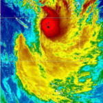
The system currently carries winds of approximately 95 km/h at its centre, but experts emphasize that the classification alone does not reflect its full danger.

According to forecasters, the cyclone’s structure has shifted into a sub-tropical system. While this technically represents a downgrade, it does not reduce its destructive potential. Instead, it broadens the storm’s reach and intensifies its multi-hazard nature.
Meteorologists warn that the most severe conditions may not coincide with the cyclone’s “eye.” In fact, heavy rain and damaging winds are expected hours before the core arrives, significantly increasing risk exposure.
Why Authorities Are Calling It “Severe and Life-Threatening”
Emergency management officials have characterized Cyclone Vaianu as an event that could produce life-threatening conditions across multiple regions.
Key threats include:


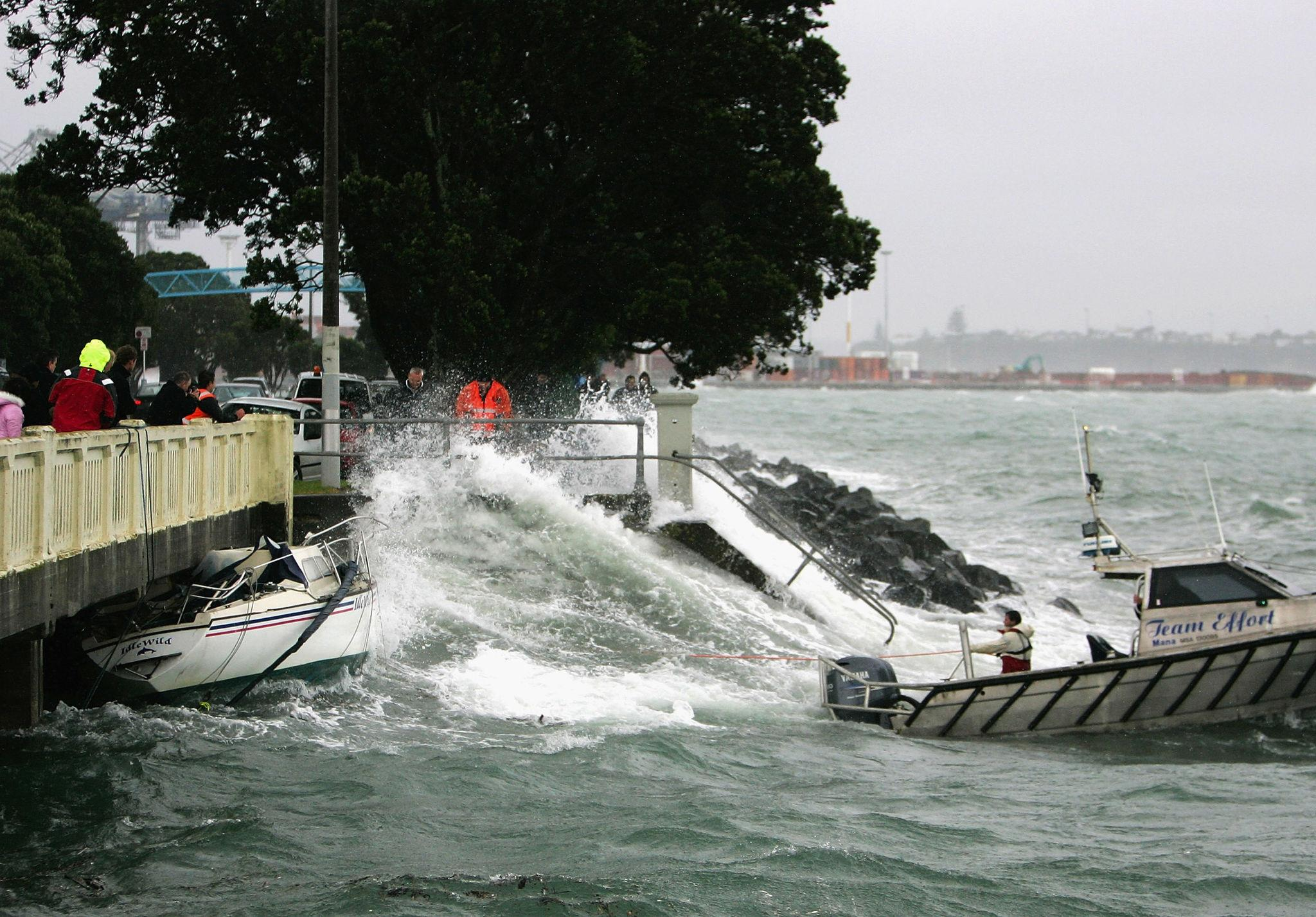
- Damaging winds capable of uprooting trees and turning unsecured objects into airborne hazards
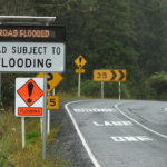
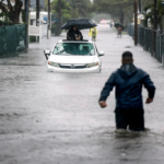
- Intense rainfall, leading to flash flooding and saturated ground conditions
- Landslides, particularly in already vulnerable areas
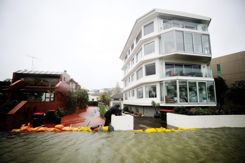
- Coastal inundation, with swells forecast between 6 to 8 metres
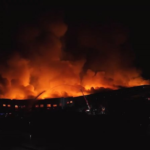
- Infrastructure disruption, including power outages, road closures, and communication breakdowns
Officials stress that the cyclone’s exact impact zones depend heavily on its track, meaning conditions could shift rapidly as new data emerges.
State of Emergency and Escalating Warnings
As the cyclone approaches, authorities have already escalated their response. A state of emergency has been declared in Northland, reflecting the seriousness of the threat and enabling rapid mobilization of resources.
Weather alerts have also intensified:
- Red-level wind warnings in high-risk areas such as the Coromandel Peninsula
- Orange heavy rain warnings across much of the North Island
- Widespread watches and alerts covering both North and upper South Island regions
Emergency services, including fire and rescue teams, have been pre-positioned across key locations, anticipating the need for rapid deployment once conditions deteriorate.
“It Will Hit Hard”: Official Warnings and Public Messaging
Authorities have adopted unusually direct language in communicating the risks.
NEMA’s Director of Civil Defence Emergency Management stated:
“It will hit hard, with a big impact on NZ. It will be significant, it will be fast, it will leave us in its wake.”
The emphasis is not only on the cyclone’s intensity but also its speed. A fast-moving storm reduces preparation windows and increases the likelihood of sudden, severe impacts.
Officials have also highlighted the cumulative effect of recent extreme weather events, warning that regions still recovering may face compounded damage.
Preparing for Impact: What Authorities Are Urging
Preparation is a central theme in all official guidance, with agencies outlining a clear strategy to reduce risk and improve resilience.
What Preparation Achieves
Preparing early helps minimize injuries, protect property, and maintain communication during disruptions such as power outages or road closures.
Key Actions Recommended
Before the Storm:
- Assemble emergency supplies, including food, water, and medical items
- Charge phones and backup power devices
- Secure outdoor items such as furniture and trampolines
- Clear gutters and drains to prevent flooding
- Develop a family emergency plan and evacuation strategy
During the Storm:
- Stay indoors and avoid unnecessary travel
- Keep away from windows and glass surfaces
- Avoid floodwaters, which can be deeper and faster than they appear
After the Storm:
- Check for injuries and structural damage
- Avoid downed power lines and unstable trees
- Follow official guidance on water safety and clean-up procedures
Authorities also warn against complacency, emphasizing that even small amounts of floodwater can sweep away vehicles and people.
Economic and Social Implications
Beyond immediate safety risks, Cyclone Vaianu is expected to have broader consequences.
Infrastructure and Transport
Road closures, landslides, and flooding could isolate communities and disrupt supply chains. Ports and maritime operations have already been adjusted, with vessels being delayed or moved offshore to avoid damage.
Power and Communications
Widespread outages are anticipated due to falling trees and strong winds, potentially affecting communication networks and emergency coordination.
Community Impact
Event cancellations, school disruptions, and evacuations are already being reported, reflecting the storm’s societal reach.
A Familiar Pattern: Lessons from Past Cyclones
Experts have drawn comparisons between Vaianu’s projected path and previous storms, particularly Cyclone Cook in 2017.
Such comparisons highlight a recurring pattern: storms entering from the north, intensifying as they move down the east coast, and leaving widespread damage in their wake.
This historical context reinforces the urgency of preparedness, particularly for communities that have experienced repeated severe weather events.
What Happens Next
As Cyclone Vaianu continues its approach, forecasts are expected to become more precise, potentially triggering further upgrades to warning levels.
Authorities remain on high alert, with emergency services fully mobilized and ready to respond. However, officials consistently emphasize that individual preparedness remains the most critical factor in reducing harm.
Conclusion: A Test of Preparedness and Response
Cyclone Vaianu represents more than a weather event—it is a test of national readiness, infrastructure resilience, and community response.
With a combination of high winds, heavy rainfall, and coastal hazards, the storm’s impact could be both immediate and far-reaching. The consistent message from authorities is clear: preparation must happen now.
As the cyclone closes in, the difference between disruption and disaster may depend on how seriously these warnings are taken.