Severe Thunderstorm Warning: What It Means and Why It Matters Now
Severe weather alerts are often issued with urgency, but few carry the immediate weight of a severe thunderstorm warning. Across multiple regions—from Central Illinois to parts of Ohio and South Africa—recent storm activity has demonstrated just how quickly conditions can escalate from routine rainfall to life-threatening weather events.
- When Storms Turn Dangerous: A Pattern of Escalation
- Understanding the Warning: A Precise Definition
- Watch vs Warning: A Critical Distinction
- The Hazards: More Than Just Rain
- Global Perspective: Severe Storm Warnings Beyond the U.S.
- Safety Protocols: What a Warning Demands
- Why Severe Thunderstorm Warnings Are Increasingly Significant
- Conclusion: A Warning That Demands Immediate Respect
This article breaks down what a severe thunderstorm warning actually means, how recent developments highlight its importance, and what individuals should do when such alerts are issued.

When Storms Turn Dangerous: A Pattern of Escalation
Recent weather events across the United States illustrate the real-world impact of severe thunderstorm warnings.


In Central Illinois, storms intensified rapidly over consecutive nights, bringing a combination of hazards: tornado sightings, hail, flash flooding, and high winds. A tornado was reported near Hopedale, followed by additional funnel cloud sightings across Peoria County within the same evening. Simultaneously, a severe thunderstorm warning was issued for nearby counties, with winds reaching 60 mph and hail the size of quarters moving through areas like Carlock.
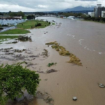
Flooding compounded the danger. Roads became impassable as several inches of water covered critical routes, and emergency agencies reported widespread disruptions due to flash flooding.


This sequence of events reflects a common pattern: severe thunderstorms are rarely isolated. They often trigger cascading risks—wind damage, flooding, and even tornado formation.
Understanding the Warning: A Precise Definition
A severe thunderstorm warning is not a general advisory—it signals that dangerous weather is either already occurring or imminent.
Meteorological standards define a severe thunderstorm as one capable of producing:
- Winds of 58 mph or higher
- Hail one inch in diameter or larger
- Heavy rainfall that may lead to flash flooding
Unlike a watch, which indicates potential conditions for severe weather, a warning requires immediate action.

In Ohio, for example, warnings were issued as storms intensified throughout the evening, with damaging winds reaching up to 70 mph and an added risk of isolated tornadoes.
Watch vs Warning: A Critical Distinction
One of the most persistent misunderstandings among the public is the difference between a watch and a warning.
- Severe Thunderstorm Watch
Indicates that atmospheric conditions are favorable for severe storms. It typically covers large regions and extended time windows. - Severe Thunderstorm Warning
Issued when a storm is actively producing severe conditions or is about to do so. It is localized and time-sensitive.
In Central Ohio, for instance, a watch covered multiple counties until 9 p.m., but a warning was later issued for Licking County when storm conditions intensified.
The transition from watch to warning is the point at which preparation must shift to immediate protective action.
The Hazards: More Than Just Rain
Severe thunderstorms are complex systems capable of producing multiple simultaneous threats:
1. Damaging Winds
Wind gusts exceeding 60 mph can uproot trees, damage buildings, and turn unsecured objects into projectiles.
2. Large Hail
Quarter-sized hail or larger can damage vehicles, roofs, and crops within minutes.
3. Flash Flooding
Heavy rainfall over saturated ground significantly increases flood risk. In some cases, just six inches of water can stall a vehicle, leading to dangerous rescue situations.
4. Tornado Formation
Although not guaranteed, severe thunderstorms can spawn tornadoes, particularly in unstable atmospheric conditions.
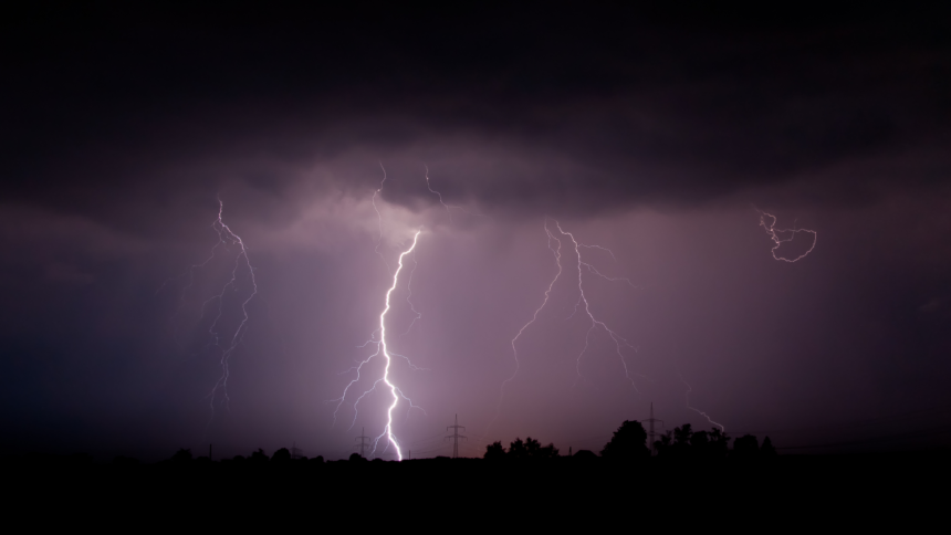
5. Lightning
Lightning remains one of the most underestimated threats. It can strike miles away from the storm core, meaning audible thunder already signals danger.
Global Perspective: Severe Storm Warnings Beyond the U.S.
Severe thunderstorm warnings are not limited to North America. In South Africa, the South African Weather Service issued a Yellow Level 2 warning, indicating a moderate but significant risk.
The warning highlighted:
- Damaging winds
- Excessive lightning
- Heavy rainfall leading to flooding
- Potential damage to infrastructure, property, and livestock
Authorities warned that vulnerable communities, particularly informal settlements, could face heightened risks due to exposure and limited infrastructure resilience.
This underscores the broader reality: while the terminology may differ slightly across regions, the underlying risks are globally consistent.
Safety Protocols: What a Warning Demands
A severe thunderstorm warning requires immediate, decisive action. The objective is to minimize exposure to multiple hazards simultaneously.
Indoors
- Stay away from windows, doors, and electrical equipment
- Avoid plumbing, including sinks and showers
- Use battery-powered devices for weather updates
- Remain inside until conditions fully clear
In a Vehicle
- Keep windows closed and avoid contact with metal surfaces
- Do not exit during active lightning
- Wait at least 30 minutes after the last thunder before leaving
During Flooding
- Never drive into standing or moving water
- Turn around if roads are submerged
- Recognize that even shallow water can disable vehicles
General Preparedness
- Enable real-time weather alerts on mobile devices
- Secure outdoor objects before storms arrive
- Bring pets indoors
- Maintain emergency supplies, including flashlights and radios
These steps are designed to reduce risk during the most volatile phase of a storm system.
Why Severe Thunderstorm Warnings Are Increasingly Significant
Recent weather patterns suggest a broader trend: severe storms are becoming more frequent and more intense in many regions.
Multiple rounds of storms across Ohio and Illinois within short timeframes have already saturated ground conditions, increasing the likelihood of flooding with each additional storm system.
Similarly, the convergence of cold fronts, high humidity, and rising temperatures continues to create ideal conditions for severe storm development.
For communities, this means:
- Greater infrastructure strain
- Increased emergency response demands
- Higher risk of economic and property damage
Conclusion: A Warning That Demands Immediate Respect
A severe thunderstorm warning is not simply a forecast—it is a real-time alert that hazardous weather is unfolding or about to occur.
Recent events across multiple regions highlight the speed and severity with which these storms can develop. From tornado sightings in Illinois to widespread flooding in Ohio and impact-based warnings in South Africa, the evidence is consistent: these warnings require immediate attention and action.
Understanding the difference between a watch and a warning, recognizing the associated risks, and following safety protocols can significantly reduce harm. As weather systems continue to intensify, public awareness and preparedness remain the most effective tools for staying safe.