Indonesia Earthquake: Inside the 7.4 Magnitude Disaster and Its Aftermath
A Sudden Shock in the Early Morning
A powerful earthquake measuring 7.4 on the Richter scale struck eastern Indonesia in the early hours of Thursday, sending shockwaves across the region and triggering immediate emergency responses. The tremor originated in the Moluccan Sea, a seismically active area situated between several Indonesian islands, and was recorded at 6:48 local time.
- A Sudden Shock in the Early Morning
- Human Impact: Casualties and Damage on the Ground
- Tsunami Threat and Rapid Response Measures
- Aftershocks and Ongoing Geological Activity
- Why Indonesia Is Prone to Earthquakes
- Emergency Response and Coordination
- Social and Economic Implications
- Looking Ahead: Preparedness and Risk Management
- Conclusion: A Region on Alert, A Nation Responding
According to seismic data, the earthquake occurred at a depth of 35 kilometers, with its epicenter located approximately 127 kilometers west-northwest of Ternate, near the province of North Maluku. The tremors were strong enough to be felt across multiple regions, including Bitung and surrounding coastal areas, where residents reported shaking lasting between 10 and 20 seconds.
The scale and intensity of the earthquake immediately raised concerns about widespread damage and the potential for secondary hazards such as tsunamis.


Human Impact: Casualties and Damage on the Ground
The human toll, though currently limited, underscores the destructive power of the earthquake. Reports confirm that at least one person has died, a 70-year-old woman in the Minahasa district of North Sulawesi, after being trapped under the rubble of a collapsed building. Another individual sustained injuries, including a leg wound.
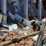
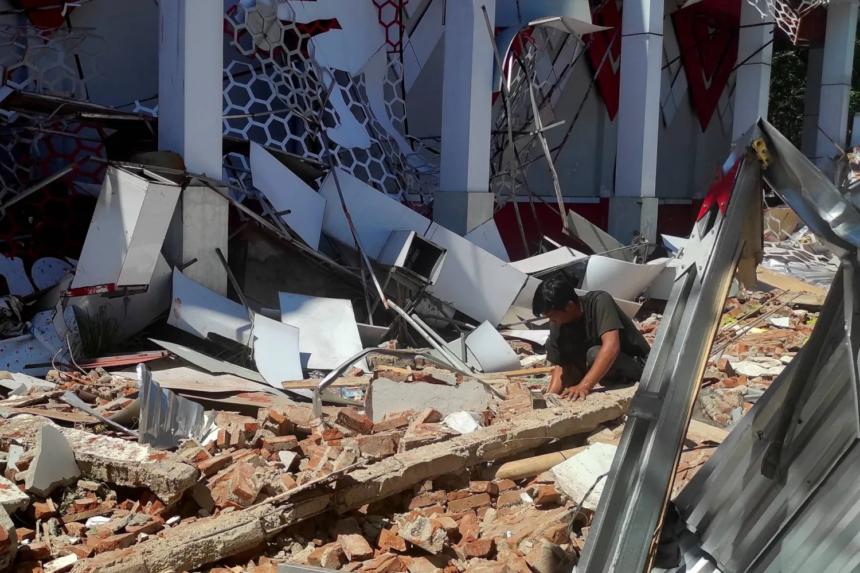
Across affected regions, significant structural damage has been reported. Several homes and buildings collapsed, particularly in vulnerable coastal and urban areas. In the city of Manado, for instance, the collapse of a building contributed directly to the confirmed fatality.


Rescue operations were launched almost immediately. Emergency teams and local authorities began search-and-rescue missions, combing through debris in an effort to locate survivors. Eyewitness accounts describe chaotic scenes, with residents seeking shelter wherever possible. In some cases, people reportedly took refuge in storage rooms or reinforced spaces as the ground shook violently.
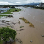
Tsunami Threat and Rapid Response Measures
Following the earthquake, authorities issued a tsunami warning, reflecting the risk posed by underwater seismic activity. The Pacific Tsunami Warning Center (PTWC) warned of potentially dangerous waves within a 1,000-kilometer radius of the epicenter.
Indeed, tsunami waves were recorded at five locations, with the highest reaching 0.75 meters in North Minahasa. While these waves were relatively modest compared to catastrophic tsunamis, they were sufficient to prompt evacuations and precautionary measures along vulnerable coastlines.
As monitoring continued, the situation stabilized, and the tsunami warning was eventually lifted, reducing immediate coastal risk.

Aftershocks and Ongoing Geological Activity
The initial earthquake was followed by a series of aftershocks, a common occurrence in tectonically active regions. Authorities recorded eleven aftershocks, the strongest registering a magnitude of 5.5.
These aftershocks not only heightened public anxiety but also complicated rescue operations. In unstable areas, damaged structures posed a continued risk of collapse, forcing emergency teams to proceed cautiously.
Indonesia’s position along the Pacific Ring of Fire—one of the most active seismic zones in the world—means such aftershock sequences are expected following major earthquakes. However, each aftershock introduces new risks, particularly in already weakened infrastructure.
Why Indonesia Is Prone to Earthquakes
Indonesia’s vulnerability to earthquakes is deeply rooted in its geographical location. The archipelago sits at the convergence of several major tectonic plates, including the Indo-Australian Plate, Eurasian Plate, and Pacific Plate.
This complex tectonic interaction results in frequent seismic activity, ranging from minor tremors to large-scale earthquakes like the recent 7.4 magnitude event. The Moluccan Sea region, in particular, is known for its active fault lines and subduction zones, where one tectonic plate is forced beneath another.
Historically, Indonesia has experienced some of the world’s most devastating earthquakes and tsunamis, making disaster preparedness a critical national priority.
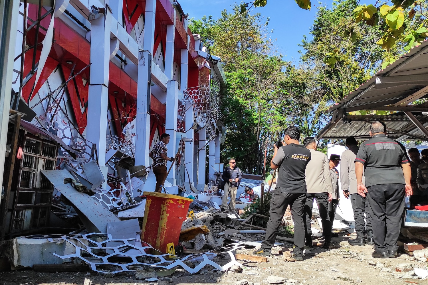
Emergency Response and Coordination
In the immediate aftermath of the earthquake, Indonesian authorities mobilized resources through agencies such as the national disaster management body and local emergency services.
The response strategy focused on three key objectives:
- Rescue operations to locate and assist trapped individuals
- Damage assessment to determine the extent of structural impact
- Public safety measures, including evacuation advisories and tsunami monitoring
Local officials confirmed that emergency services were deployed rapidly, with teams working under challenging conditions to stabilize affected areas and provide medical assistance.
Social and Economic Implications
While the current casualty count remains relatively low, the broader implications of the earthquake extend beyond immediate loss of life.
Infrastructure Damage
Collapsed buildings and damaged homes disrupt daily life, displacing residents and requiring reconstruction efforts. In regions where infrastructure is already limited, recovery may take considerable time.
Economic Disruption
Local economies—particularly in coastal towns—face interruptions due to damaged facilities, halted business activities, and safety concerns. Tourism, a significant sector in parts of Indonesia, may also experience short-term impacts.
Psychological Effects
Earthquakes often leave lasting psychological effects on affected communities. The suddenness of the event, combined with aftershocks and uncertainty, can contribute to stress and trauma among residents.
Looking Ahead: Preparedness and Risk Management
This latest earthquake serves as a reminder of Indonesia’s ongoing exposure to natural disasters and the importance of preparedness.
Efforts moving forward are likely to focus on:
- Strengthening early warning systems, particularly for tsunamis
- Improving building resilience in earthquake-prone areas
- Enhancing community awareness and evacuation protocols
- Investing in rapid-response infrastructure to reduce casualties
Authorities will also continue monitoring seismic activity in the region, as aftershocks and secondary risks remain possible in the coming days.
Conclusion: A Region on Alert, A Nation Responding
The 7.4 magnitude earthquake in Indonesia underscores both the power of natural forces and the resilience of communities that live in their shadow. While the immediate loss of life appears limited, the damage and disruption highlight ongoing vulnerabilities.
Swift emergency responses, combined with effective monitoring systems, helped mitigate the potential for a larger disaster—particularly in managing the tsunami threat. However, the event reinforces a broader reality: in a region defined by tectonic activity, preparedness is not optional but essential.
As recovery efforts continue, the focus will remain on rebuilding, supporting affected communities, and strengthening defenses against future seismic events.